The 75 Years of Innovation series highlights the groundbreaking innovations spanning from SRI’s founding in 1946 to today. Each week, SRI will release an innovation, leading up to its 75th anniversary in November 2021.
A high quality, real-time video system for advanced situational understanding
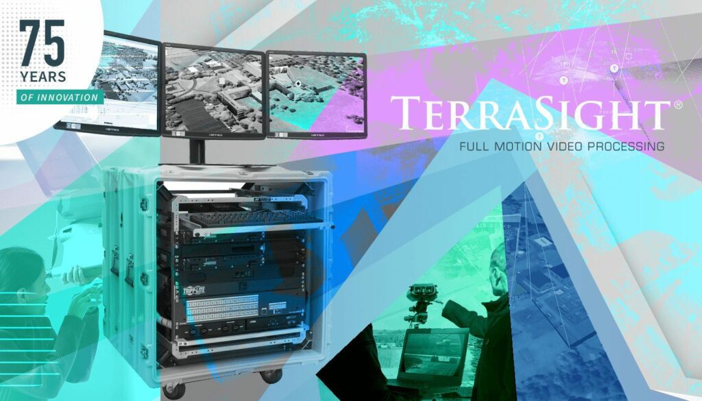
SRI International’s TerraSight™ Software for Situational Intelligence
Video entered the world of surveillance in 1961 when London first used it for transport security. RCA (now part of SRI International) was instrumental in developing the solid-state charge-coupled device (CCD), a light-sensitive integrated circuit that allowed visual images to be converted to digital form. CCDs allowed cameras to be used in low light, which laid the groundwork for modern video surveillance.
SRI has a long history of innovation in imaging and broadcast cameras, and continues to innovate in these areas. In the late 2000s, SRI introduced a new system known as TerraSight™ that redefined what was possible in air and ground video surveillance.
A better view of things with TerraSight™
The U.S. military has exacting demands for air and ground military surveillance. Inaccurate images could lead to strategic errors, failed missions or even lost lives. The military uses a framework known as C4ISR (for Command, Control, Communications, Computers, Intelligence, Surveillance, and Reconnaissance) to refer to organizational and technological instruments used to enhance, reinforce or execute command and control strategies. The TerraSight™ surveillance technology adds capabilities to C4ISR by ensuring the precision of context-rich information used by mission commanders, tactical operators and image analysts.
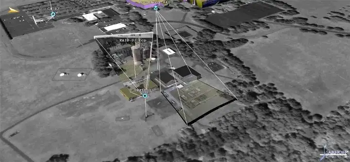
Using advanced image processing, TerraSight™ generates a composite common operating picture (COP) in real-time from a wide variety of input variables. Based on a modern service-oriented architecture (SOA) and using open standards, TerraSight™ is extensible and interoperable; its software components are reusable via service interfaces based on common, open communication standards. Using these open standards means that the platform can be quickly incorporated into new applications.
TerraSight generates vital information that is useful in the field, including geo-registration assignment, which provides accurate 3D coordinates to every pixel, and moving target indication, that maintains image tracks from camera to camera. And it bases this information on reference imagery and terrain, leading to improved accuracy.
The TerraSight Components
TerraSight™ is a modular framework originally comprised of three main components:
TerraSight™Manager: This is where real-time video processing, synchronization, geolocation and streaming happens. The TerraSight™ Manager provides moving target indication, which is used to highlight moving objects in stabilized video.
TerraSight™ 3D Visualizer: This component overlays video onto an image map. This capability combines up to eight live video feeds to provide situational awareness. This is then used to build up a picture that is overlaid across a 3D model of the Earth. The visualizer also supports a point-and-click feature in which a user can target a location and correct for elevation.
TerraSight™Server: The images and data generated using the TerraSight platform can be stored, searched and sent in real-time. The server supports a live/DVR playback and streaming functionality for each sensor. TerraSight server can be configured, and its health can be monitored through a centralized web-based interface.
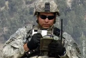
In 2012, TerraSight added a new component, the TerraSight™ Salience-Based Compression (SBC) Module. SBC provides full-motion capture that allows dismounted soldiers to use handheld devices to view and communicate mission-critical information. This technology allows full-motion video and metadata to be sent across low-bandwidth networks while maintaining high-quality video. The SBC module is an important development for use in mobile command posts that may not have access to reliable Wi-Fi.
Getting a better sight of things
TerraSight™ software was designed to develop actionable data from video and images, even in difficult conditions such as poor bandwidth. While advanced technology often goes out-of-date rather quickly, SRI worked to futureproof the TerraSight system by focusing on its extensibility and interoperability. As a result, TerraSight™ can be easily integrated into existing and newly-developed systems, from large, multi-sensor, or multi-processing workstations for field applications to laptops performing single-sensor or forensic analysis. This capability, alongside the excellence in image capture and interpretation, makes TerraSight a technology that crosses many boundaries.
In 2012, SRI released TerraSight™ EX, a lightweight version of the TerraSight™ platform. TerraSight™ EX was designed to be portable, running on a Windows laptop. TerraSight EX processes standard video feeds from an unmanned aerial system and converts them into real-time, integrated tactical information to further enhance situational awareness.
With TerraSight™, SRI International provides an exemplar of sustainable and interoperable software design. By basing the components on a service-oriented architecture and using open standards for communications, SRI has ensured that TerraSight will continue to be useful in present and future C4ISR applications.
Resources
YouTube, SRI International, Presentation of TerraSight at Technology Conference/FPED, 2009: https://youtu.be/WAsyJcZPNOM
SRI International, TerraSight Product Guide: https://www.digchip.com/datasheets/3316462-terrasight-terrasight-video.html
SRI International Press Release, 2012: https://www.prnewswire.com/news-releases/terrasight-video-exploitation-now-offers-full-motion-video-capabilities-to-warfighters-on-foot-139434748.html