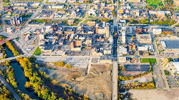
Researchers are combining detailed aerial maps with 3D data to advance sensing and imaging technologies—leading to better compression and data preservation.
Whether it’s for mapping a landscape, visualizing the detailed anatomy of a patient, or analyzing the structures around a self-driving car, three-dimensional imaging has become an increasingly powerful tool. Thanks to advancements in 3D sensors and imaging techniques, researchers are able to collect more detailed 3D data than ever before.
But to be of use, this huge amount of data must be processed, stored, and shared. Researchers at SRI’s Center for Vision Technologies (CVT) have been developing and improving techniques to compress 3D data effectively, reducing the size of data files while still preserving the most important information.
“You want to go from an exact point with the original geometry to something with slightly more error, so it can occupy less space,” said Bogdan Matei, a technical manager for CVT. “But you want that change to be generally imperceptible, like a photographer going from a high-quality RAW file to a compressed JPEG.”
Matei and his colleagues are focusing on data obtained from LIDAR, a 3D scanning technique that involves rapidly bouncing a laser off of distant objects to create 3D maps made up of millions of individual points. To compress this data, they are finding ways to group points together.
In a landscape, some objects can be represented by fewer points than others. Man-made structures, for example, tend to have smooth sides and uniform construction. One of the compression methods the researchers have developed takes advantage of this by linking all the data about, say, the flat top of a building as if it were one big pixel in an image.
“A key aspect is that we use the semantics of the scene. What is the ground? What is a building? What is a car? We assume all that is known,” Matei said. “Because buildings and ground have more redundancy in the data, they can be compressed more than, let’s say, a tree.”
And because they are working with overhead mapping data, much of the vertical information is empty space, Matei said. The researchers are able to store a lot of the data in two dimensions instead of three, making it even smaller. Using this method, the researchers found that they could compress LIDAR data three to seven times more than the standard method of compression, known as LAZ, although their method does lose more data.
The second method that the researchers are working on can compress data as much as 30 times more than LAZ, with acceptable levels of data loss. It relies on the assistance of neural networks, which use an interconnected series of algorithms to process and analyze data. In this case, the researchers have trained the network to recognize and compress point data.
“Rather than having an explicit list of points on a surface, you find its equation,” Matei said. “But it’s not a simple equation—it’s a complicated function that is learned with a deep neural network.”
That function takes up less space than storing each individual point. Moreover, the researchers found that they could train a generalized network ahead of time and then adjust its parameters for specific data sets, making it even more effective.
“The big network is like a universal dictionary of shapes, then you can adapt it for a particular data set and compress things differently based on their class,” Matei said. “For example, with vegetation, you don’t need much precision for some applications. So you can compress it a lot.”
The researchers are hoping they can improve on both methods of compression, making it easier to collect and store data for aerial mapping, training self-driving cars, or other forms of artificial intelligence.
“It can become very complicated because these points can have color or other attributes as well,” Matei said. “We want to refine what we’ve done and improve the compression even further.”


